Introduction
Singapore, a bustling metropolis known for its efficient infrastructure boasts a network of roads that form the arteries of the city-state. In this article, we delve into Singapore’s road intricacies, design, significance, and role in island-wide mobility.
(To learn more about Singapore’s Drivers License Exam, click here: https://learntodrivesg.com/)
Urban Planning and Road Network
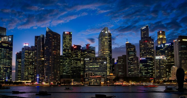
Singapore’s road network is a testament to the city-state’s commitment to urban planning excellence. Orchestrated with precision, the road system is designed to optimize traffic flow and accommodate the diverse needs of commuters and businesses.
At the heart of Singapore’s road network lies an extensive grid of arterial roads, expressways, and major thoroughfares that traverse the island from north to south, east to west. These primary arteries form the backbone of the transportation infrastructure, providing vital links between residential areas, commercial hubs, industrial zones, and recreational destinations.
Key Features and Significance
Singapore’s roads are characterized by several distinctive features that contribute to their efficiency and functionality. One notable aspect is the integration of intelligent transportation systems (ITS) and advanced traffic management technologies. These include real-time traffic monitoring, adaptive traffic signal control, and electronic toll collection systems, which help to minimize congestion, optimize traffic flow, and enhance overall safety on the roads.
Another hallmark of Singapore’s road network is the meticulous attention to detail in road design and maintenance. From smooth asphalt surfaces to clearly marked lanes and signage, every aspect of the road infrastructure is meticulously maintained to ensure optimal safety and comfort for road users.
Furthermore, Singapore’s roads are interspersed with green spaces, landscaped medians, and pedestrian-friendly amenities, reflecting the city-state’s commitment to creating a sustainable and livable environment. These features not only enhance the aesthetic appeal of the roads but also promote active mobility and community interaction.
Challenges and Solutions
Despite the meticulous planning and ongoing efforts to enhance the road network, Singapore faces several challenges in managing its urban transportation system. One pressing issue is the perennial problem of traffic congestion, exacerbated by the limited land area and high population density of the island.
To address this challenge, Singapore has implemented a comprehensive suite of measures aimed at promoting sustainable mobility and reducing reliance on private vehicles. These include extensive public transportation networks, incentivizing carpooling and alternative modes of transport, as well as promoting active mobility through cycling and walking initiatives.
Expressways
Lifelines of Connectivity Singapore’s expressway network forms the lifelines of connectivity, providing swift and efficient transportation across the island. Engineers design these highways for high-speed travel, prioritizing smooth flow and safety.
The Pan Island Expressway and the Central Expressway are among the busiest and link residential estates to the central district. These expressways serve as vital conduits for commuters, facilitating the daily flow of traffic between home and work.
The East Coast Parkway (ECP) offers coastal views as it stretches from eastern shoreline linking the CBD to Changi Airport. Known for its recreational amenities, the ECP serves as a popular route for leisurely drives and weekend outings.
Major Thoroughfares
Singapore boasts a network of major thoroughfares that crisscross the island, providing essential connectivity to various neighborhoods.
Orchard Road stands as Singapore’s premier shopping and entertainment belt, lined with luxury boutiques, department stores, and vibrant nightlife establishments. This iconic thoroughfare serves as a magnet for locals and tourists alike, to indulge in retail therapy and culinary delights.
Serangoon Road, located in the heart of Little India, is a bustling thoroughfare steeped in culture and heritage.
Nathan Road, earns renown for its elegant boulevards and stately colonial-era homes. This leafy thoroughfare offers a tranquil escape from the bustle of the city, providing residents with a serene oasis.
Iconic Landmarks
Singapore’s roads feature iconic landmarks that act as navigational beacons and cultural symbols.
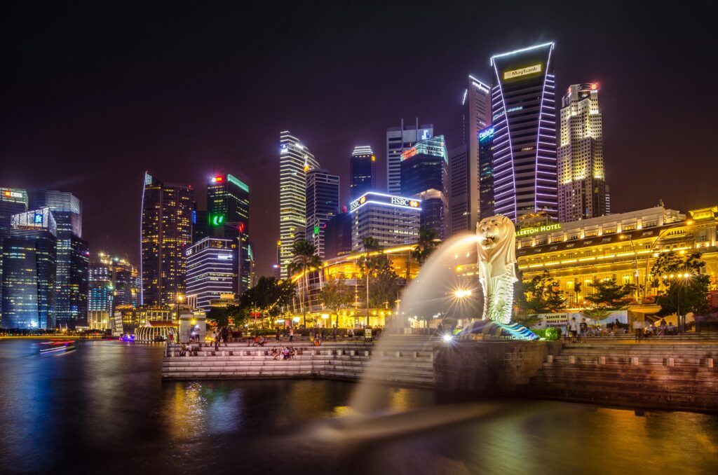
The Merlion, an iconic symbol of Singapore, stands proudly at Marina Bay, overlooking the city skyline. This mythical creature embodies the spirit of Singapore’s maritime heritage and lion city legacy.
The Marina Bay Sands Resort, with its distinctive triple towers, is a modern marvel with Singapore’s skyline. This architectural masterpiece serves as a beacon of luxury and entertainment, attracting visitors from around the world.
The Singapore Flyer, a towering observation wheel situated on the waterfront promenade, offers panoramic views of the cityscape and beyond.
Conclusion
As we conclude our exploration of Singapore’s roads and landmarks, we have uncovered the connectivity that defines the island nations. From bustling expressways to vibrant thoroughfares and iconic landmarks, Singapore’s roads serve as vital conduits of mobility, culture, and commerce.