Singapore, a vibrant metropolis and global hub, boasts one of the most advanced and efficient road networks in the world. The city-state’s roads are not just pathways for vehicles; they are a testament to meticulous urban planning, cutting-edge engineering, and a commitment to sustainability. This article explores the evolution, design, and unique features of Singapore’s road infrastructure.
Read more articles here: https://learntodrivesg.com/blog/
Singapore’s Historical Evolution
The road network in Singapore has evolved significantly since its early days as a British colony. The initial roadways were basic, primarily serving colonial administrative needs and the burgeoning port activities. Post-independence, under the leadership of Prime Minister Lee Kuan Yew, Singapore embarked on a transformative journey to modernize its infrastructure. This period saw the expansion of road networks to accommodate the rapidly growing population and the increasing number of vehicles.
Road Network Design in Singapore
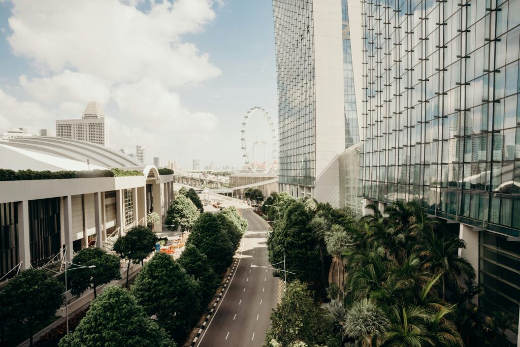
Singapore’s road system is designed with a hierarchical structure, comprising expressways, major arterial roads, collector roads, and local access roads. This hierarchy ensures smooth traffic flow and efficient connectivity between different parts of the city.
- Expressways: Singapore’s expressways are the backbone of the road network, facilitating fast and efficient movement across the island. Notable expressways include the Pan Island Expressway (PIE), the Central Expressway (CTE), and the East Coast Parkway (ECP). These expressways are meticulously maintained and equipped with modern features such as electronic toll collection (ERP) to manage congestion.
- Arterial Roads: These roads link various districts and are crucial for distributing traffic from expressways to local streets. They are designed to handle high volumes of traffic and are often lined with commercial and residential developments.
- Collector Roads: Serving as intermediaries between arterial roads and local streets, collector roads balance traffic distribution and provide access to neighborhoods and local amenities.
- Local Access Roads: These roads are the final link in the hierarchy, providing direct access to homes, schools, and other local facilities.
Technological Integration
Singapore’s road network is heavily integrated with technology to enhance traffic management and safety. The Intelligent Transport System (ITS) leverages real-time data to monitor and control traffic flow, providing updates to drivers and optimizing signal timings. The Electronic Road Pricing (ERP) system, introduced in 1998, uses dynamic pricing to manage congestion during peak hours, ensuring a smoother and more predictable journey for motorists.
Sustainability and Innovation
Sustainability is a core principle in Singapore’s road infrastructure planning. The city-state has pioneered green initiatives such as green roofs on bus stops and vertical greenery along flyovers. These measures not only enhance the aesthetic appeal but also contribute to reducing urban heat and improving air quality.
In recent years, Singapore has been at the forefront of adopting electric vehicles (EVs) and developing the necessary charging infrastructure. The government’s push towards a car-lite society includes promoting public transport, cycling, and walking, which are seamlessly integrated into the urban landscape.
Challenges and Future Prospects in Singapore
Despite its exemplary road network, Singapore faces challenges such as land scarcity and increasing vehicle ownership. The government continues to address these issues through innovative solutions like the expansion of the Mass Rapid Transit (MRT) system, promoting ride-sharing, and implementing stringent vehicle ownership controls.
Looking ahead, Singapore is exploring autonomous vehicle (AV) technology, with trials already underway in selected areas. The integration of AVs is expected to further enhance road safety, reduce congestion, and provide more efficient transportation options.
Expansion and Enhancement Projects
1. North-South Corridor (NSC)
The North-South Corridor is Singapore’s first integrated transport corridor, combining expressway and dedicated bus lanes, cycling paths, and pedestrian walkways. It aims to improve connectivity between the northern residential estates and the city center, reducing travel time and enhancing commuting options. Scheduled for completion by 2026, it includes innovative features like noise barriers with integrated solar panels and rainwater harvesting systems.
2. Thomson-East Coast Line (TEL) Integration
The Thomson-East Coast Line is Singapore’s sixth MRT line, connecting the northern parts of Singapore to the eastern regions and the city center. As part of its integration, the TEL will feature interchanges with key road networks, facilitating seamless transfers between rail and road transport modes. This integration is set to enhance overall transport efficiency and reduce congestion along major road corridors.
Sustainable Initiatives and Technological Integration
3. Green Transport Solutions
Singapore continues to promote sustainable transport solutions, including the adoption of electric vehicles (EVs) and the expansion of EV charging infrastructure across the island. Plans are underway to incentivize EV ownership and enhance charging facilities to support the growing demand for cleaner transportation options.
4. Smart Mobility Solutions
Building on its Intelligent Transport System (ITS), Singapore is exploring advanced technologies such as connected vehicles and autonomous vehicles (AVs). Trials of AVs are ongoing in designated areas to test their feasibility and integration into the existing road network. These technologies aim to improve road safety, optimize traffic flow, and enhance overall transport efficiency.
Enhancing Urban Livability and Accessibility
5. Enhanced Cycling and Walking Infrastructure
To promote a car-lite society and encourage active mobility, Singapore is expanding its network of cycling paths and pedestrian-friendly walkways. These efforts not only support environmental sustainability but also contribute to improving public health and urban livability.
6. Integrated Transport Hubs
Future plans include the development of integrated transport hubs at key MRT stations, combining multiple transport modes such as buses, taxis, and cycling facilities. These hubs aim to streamline commuter journeys, reduce transfer times, and improve overall transport connectivity within neighborhoods and across the island.
Conclusion
The roads of Singapore are more than just thoroughfares; they are a symbol of the city’s forward-thinking approach and commitment to creating a sustainable, efficient, and livable urban environment. Through continuous innovation and strategic planning, Singapore’s road network remains a model for cities worldwide, demonstrating how infrastructure can adapt and thrive in a rapidly changing world.